Top Landmarks in Oakland
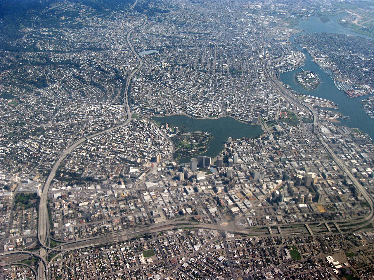
Oakland sits at the eastern edge of San Francisco Bay, and its landmarks reflect the city's layered development from a nineteenth-century port into one of the Bay Area's largest urban centers, home to around 438,000 residents. The sites that define Oakland's public identity are spread across three distinct geographic zones — the Lake Merritt district, the Downtown and Uptown corridor, and the waterfront at Jack London Square — with a separate cluster of hillside destinations that require a bit more planning to reach. This guide walks through the landmarks most commonly associated with Oakland, explains why each is worth your time, and shows how the flatlands sites connect on foot.
Lake Merritt and the Lakeside District
Lake Merritt is the geographic and cultural anchor of Oakland. The lake is a large tidal lagoon sitting at the center of the city, ringed by a multi-mile public path and open parkland. In 1870 the State of California designated it as the first wildlife refuge in the United States — a distinction Oakland's lake still holds — and today it functions as both a recreational greenway and an active bird sanctuary.
Walking the full perimeter of the lake is the most popular way to take in the area. The path connects several worthwhile stops and gives a clear sense of the residential neighborhoods that press up against the water.
Children's Fairyland occupies the northern shore and has been a fixture at Lake Merritt since 1950, placing it among the longest-operating storybook-themed parks in the country. It is commonly cited as a place Walt Disney visited before developing Disneyland, though the park stands on its own as a piece of Oakland's social history regardless of that connection. Admission is required; check the park's official site for current hours and pricing.
The Camron-Stanford House, on the western shore, is the last surviving example of the large Victorian residences that once lined the lake. Built in 1876, it now operates as a museum dedicated to the domestic life of Oakland's Victorian era. Tours are available — confirm current access on the house's official website.
The Rotary Nature Center is also on the lakeshore and focuses on the ecological character of the refuge: the migratory birds, the tidal marsh, and the wildlife that the lake still sustains year-round. It's a low-key stop that puts the natural side of Lake Merritt in context.
The Oakland Museum of California (OMCA) stands just a few blocks from the lake's eastern edge on Oak Street. It is Oakland's principal cultural institution, housing extensive collections covering California art, history, and natural sciences together under one roof. The building's terraced garden levels are themselves worth seeing. Check the museum's website for current hours and admission.
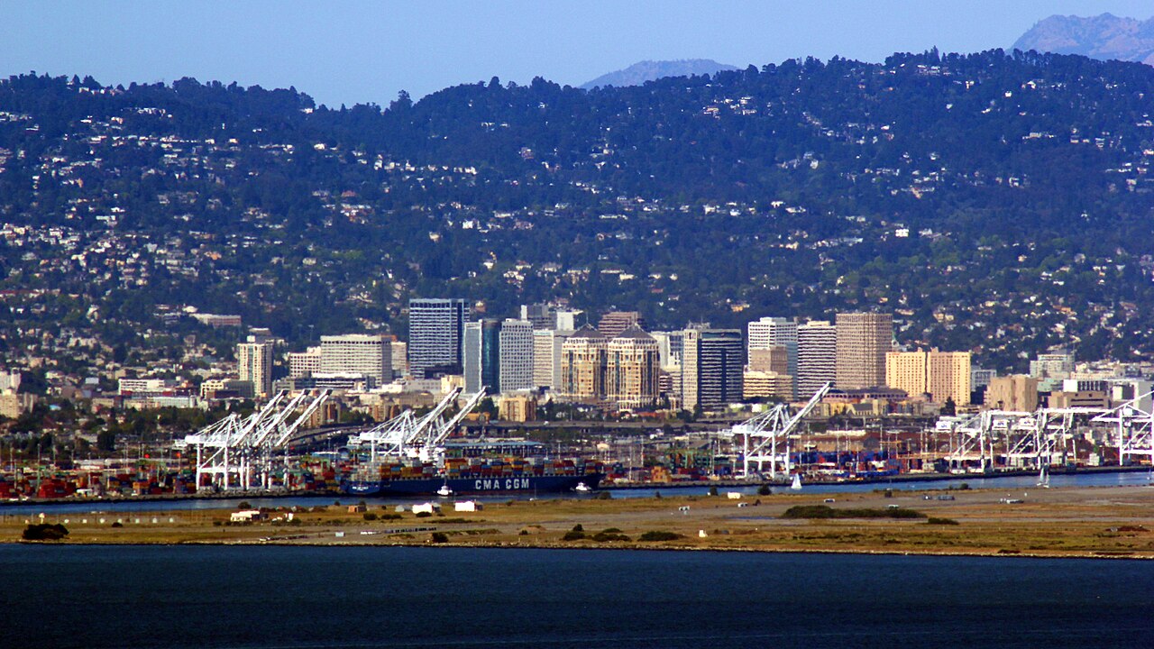
Downtown and Uptown Oakland
A short walk from the Lake Merritt cluster brings you into Oakland's downtown core, where several of the city's most architecturally significant buildings are within a few blocks of one another.
Oakland City Hall on Frank H. Ogawa Plaza is one of the more distinctive municipal buildings in California. Completed in 1914, its 18-story tower was among the first high-rise city halls constructed in the United States. The building survived the 1989 Loma Prieta earthquake, which caused significant damage throughout the Bay Area, and it remains the functioning seat of Oakland's city government.
The Paramount Theatre on Broadway is widely recognized as one of the finest examples of Art Deco architecture on the West Coast. Opened in 1931 and restored in the 1970s, it continues to operate as a performing arts venue. The facade features large mosaic panels, and the interior auditorium retains its original Art Deco detailing to a degree that is relatively rare in a still-active theater. The Paramount is listed on the National Register of Historic Places. Check the venue's official site for current programming and tour availability.
The Fox Theater, several blocks north on Telegraph Avenue in the Uptown neighborhood, is another Art Deco landmark worth a look. Originally opened in 1928, it sat vacant for decades before an extensive restoration completed in 2009 returned it to use as a concert and events venue. The illuminated marquee is among the most photographed spots in Oakland's Uptown district. Check the venue's website for current programming.
The Broadway corridor connecting these two theaters runs through a stretch of Oakland that also has a concentration of independently owned restaurants and bars — a practical detail for planning an evening around a performance at either venue. For a broader overview of dining in the area, see Where to Eat in Oakland.
Jack London Square
Oakland's waterfront district takes its name from the author Jack London, who grew up in Oakland and worked on the waterfront as a young man. The square and adjacent streets form a walkable stretch along the estuary separating Oakland from Alameda, with a mix of restaurants, a ferry terminal, and two historically significant stops.
The USS Potomac is docked here. This 165-foot vessel served as President Franklin D. Roosevelt's presidential yacht, earning the informal designation "FDR's Floating White House." It is a National Historic Landmark and is open for tours — check the official site for current schedules and access.
Heinold's First and Last Chance Saloon is a small bar steps from the waterfront that has operated continuously since 1883, making it one of Oakland's oldest businesses. The building tilted noticeably during the 1906 earthquake and has remained at that angle ever since — the sloped floor is immediately apparent when you walk in. Jack London is said to have used the saloon as a place to read and study as a young man.
Jack London Square is roughly a mile from Oakland City Hall, making it a reasonable walk from the downtown landmarks along Broadway, and it also connects directly to the Oakland Ferry terminal for service across the bay.
The Oakland Hills
The hills east of Oakland's flatlands require a separate outing from the downtown and waterfront sites, but they contain some of Oakland's most visually striking landmarks.
The Oakland California Temple of The Church of Jesus Christ of Latter-day Saints sits prominently in the hills and is visible from broad stretches of the Bay Area. Dedicated in 1964, its white spires and elevated position have made it a recognizable part of Oakland's skyline for more than sixty years. The grounds are generally open to visitors; a visitor center is typically available, though the interior of the temple is not open to the general public. Confirm current visitor center hours on the official church website.
Joaquin Miller Park is Oakland's largest municipal park, named after the poet Cincinnatus Heine Miller — known as the "Poet of the Sierras" — who lived in the Oakland hills in the late nineteenth and early twentieth centuries. The park contains several structures Miller built himself, including the ruins of his home known as The Abbey. It connects to the broader East Bay Regional Park District trail network and offers wooded walking and running trails well removed from the city's flatlands character.
Chabot Space & Science Center is located at the edge of Joaquin Miller Park and houses a planetarium, a large exhibit hall covering space science and exploration, and two major telescopes used for public viewing. Check the center's official website for current admission, exhibition schedules, and public telescope nights.
How the Landmarks Cluster — and How to Combine Them
Oakland's flatlands landmarks break into three walkable clusters:
The Lake Merritt group — Lake Merritt itself, Children's Fairyland, the Camron-Stanford House, the Rotary Nature Center, and OMCA — can be covered in a single morning or afternoon on foot, with the lakeshore path linking most of them.
The Downtown/Uptown corridor — Oakland City Hall, the Paramount Theatre, and the Fox Theater — sits within a half-mile stretch of Broadway and Telegraph Avenue. OMCA connects to this group with about a ten-minute walk westward.
The Jack London Square waterfront — the USS Potomac and Heinold's First and Last Chance Saloon — is roughly a mile south of City Hall along Broadway, making it a natural endpoint for a full day that starts at the lake, moves through downtown, and finishes at the water.
The hills landmarks — Joaquin Miller Park, the Oakland California Temple, and Chabot Space & Science Center — are not walkable from the flatlands in a reasonable outing. Plan them as a separate half-day, using a car, rideshare, or the Oakland hills bus routes.
Getting Around
BART serves downtown Oakland with several stations, and the regional system connects Oakland to San Francisco and other Bay Area destinations. Local bus service runs throughout the flatlands and into the hills. Contactless tap-to-pay is accepted across the regional transit network; check the official AC Transit and BART websites for current fares and routes.
For the Lake Merritt–Downtown–Jack London Square loop, most people find the distances manageable on foot. Street parking is available throughout these neighborhoods, though availability and conditions vary by block and time of day — standard urban awareness applies.
Plan Your Visit
For a broader look at what Oakland offers, the Oakland Travel Guide: Things to Do, Landmarks, Food, and Itineraries covers the city across categories. If you're building a day-by-day schedule, the Oakland 1-Day Itinerary sequences the flatlands landmarks efficiently for a single day, while the Oakland 3-Day Itinerary adds time for the hills, the waterfront, and Oakland's neighborhoods. For questions about timing your trip, Best Time to Visit Oakland covers the seasonal factors worth knowing. For common logistical questions, the Oakland FAQ is a good reference.