Top Landmarks in Martinez
Martinez, California, sits along the Carquinez Strait in Contra Costa County, and its most notable landmarks reflect two long threads in the city's story: its role as a county seat with a walkable historic downtown, and its connection to naturalist John Muir, who made his home here for decades. For visitors piecing together a day or two in the area, the good news is that most of the landmarks worth seeing cluster within a few miles of each other, making it possible to combine several stops without much backtracking. This guide walks through the landmarks most commonly associated with Martinez, how they relate to one another geographically, and how to link them into a single outing. For a broader overview of the city, the Martinez Travel Guide: Things to Do, Landmarks, Food, and Itineraries is a useful starting point before diving into specifics.
John Muir National Historic Site
The centerpiece landmark most people associate with Martinez is the John Muir National Historic Site, administered by the National Park Service. The site preserves the Victorian-era home where the conservationist and Sierra Club founder lived with his family, along with surrounding orchard land that speaks to the property's agricultural history. Also part of the site is the Vicente Martinez Adobe, an earlier residence connected to the family for whom the city is named, which sits a short distance from the main house. Together, the buildings and grounds offer a look at both the region's Californio-era ranching past and the later fruit-growing era that shaped this part of Contra Costa County. Because operating details for National Park Service sites can change, it's worth checking the official NPS page for current visiting information before planning a stop. The John Muir site is a bit removed from downtown, so most visitors treat it as its own stop rather than folding it into a downtown walk.

Downtown Martinez Historic District
Downtown Martinez, centered around Main Street and Court Street near the Contra Costa County Courthouse, is the most walkable concentration of landmarks in the city. The historic district includes early-20th-century commercial buildings, several murals depicting local history, and the county courthouse itself, a landmark building that has anchored civic life in Martinez since the county seat was established here. Wandering this area gives a sense of Martinez's identity as a working county seat rather than a purely tourist-oriented town, with government offices, longtime storefronts, and public art sharing the same few blocks. This is also the part of town where Where to Eat in Martinez becomes relevant, since downtown has the highest concentration of restaurants and cafes within walking distance of the other landmarks.
Martinez Waterfront and Marina
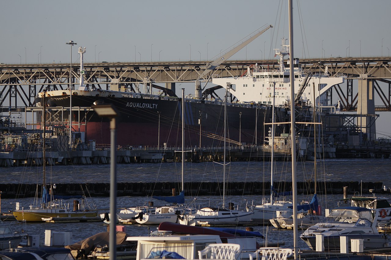
A short walk downhill from downtown brings visitors to the Martinez waterfront along the Carquinez Strait, anchored by the Martinez Marina and the adjoining shoreline park. This stretch of waterfront offers views across the strait toward the Benicia-Martinez Bridge and is a commonly visited spot for walking, fishing, and simply taking in the water. The waterfront also connects to a segment of regional shoreline trail, which draws cyclists and walkers moving along the strait beyond the immediate marina area. Because the marina sits just below downtown, it pairs naturally with a downtown historic district walk, and many visitors treat the two as a single loop rather than separate outings.
Martinez Amtrak Station
The Amtrak station in Martinez, a stop on the Capitol Corridor and other routes, is itself a recognizable landmark thanks to its historic depot building near the waterfront. Even for visitors not arriving by train, the station area is worth noting because of its architecture and its role as a functioning transit hub connecting Martinez to other Bay Area cities. If arriving by train or bus rather than by car, this station is likely to be a visitor's first point of contact with the city, and it sits close enough to both downtown and the waterfront to serve as a natural starting point for a walking route.
Joe DiMaggio Connection
Martinez holds a notable claim as the birthplace of baseball player Joe DiMaggio, and the city marks this connection with a plaque and public recognition in the downtown area. While this isn't a large-scale attraction on the order of the John Muir site, it's a detail that comes up often in descriptions of the city and adds another layer to a downtown walk for visitors interested in local history and trivia.
Putting It Together: A Walking Route
Given the geography, a practical way to see the core landmarks is to start downtown near the courthouse and historic commercial blocks, walk down toward the marina and waterfront for views of the Carquinez Strait, then loop past the Amtrak depot before heading back up into downtown. The John Muir National Historic Site is best treated as a separate stop, since it sits at a distance from the downtown cluster and merits unhurried time on its own. Visitors planning a fuller schedule around these landmarks may find it useful to consult the Martinez 1-Day Itinerary for a single-day structure, or the Martinez 3-Day Itinerary for a more relaxed pace that leaves room for the waterfront trail and nearby dining.
Planning Notes
Martinez is a small city, with a population of roughly 36,900 according to recent U.S. Census Bureau estimates, and its downtown and waterfront are compact enough to cover on foot once parked or dropped off in the city center. As with any downtown or waterfront area, ordinary urban awareness is worth keeping in mind, particularly around the transit station and after dark. For seasonal considerations, including weather patterns along the strait that can affect a waterfront walk, see Best Time to Visit Martinez. For additional practical questions about getting around or timing a visit, the Martinez FAQ covers common visitor questions, and the Best Things To Do in Martinez page rounds out this landmarks guide with activities beyond the historic sites themselves.